Lost and Found | Orienteering Course at Spring Creek Park
Scouting can take you on some unexpected adventures; the lost (and found!) orienteering course at Spring Creek Park is exactly one of those unexpected family adventures.
Our son is working on completing his First Class rank. The final piece was the orienteering requirement.
NAVIGATION
BSA
4a. Using a map and compass, complete an orienteering course that covers at least one mile and requires measuring the height and/or width of designated items (tree, tower, canyon, ditch, etc.).
I’m going to warn you now – this is not a work smarter, not harder story – but, it was a lot of fun!
Our troop did offer an orienteering weekend event but we were not able to attend, and sadly First Class Emphasis days are lacking over the past few years (we’ll continue to blame pandemic motivation). So, our adventure began by taking our boys orienteering.
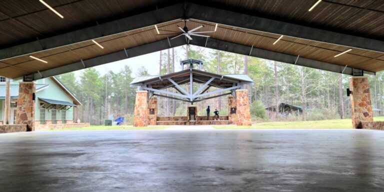
A quick Google search shows that there are very few orienteering courses around Houston and the ones that are in place were pretty far from us or more complicated than we were prepared to tackle. However, we recalled that there was a course at a nearby city park. We even had the course instructions – so we set out to see if we could still run the course at Spring Creek Park in Tomball, TX.
Finding the Existing Course
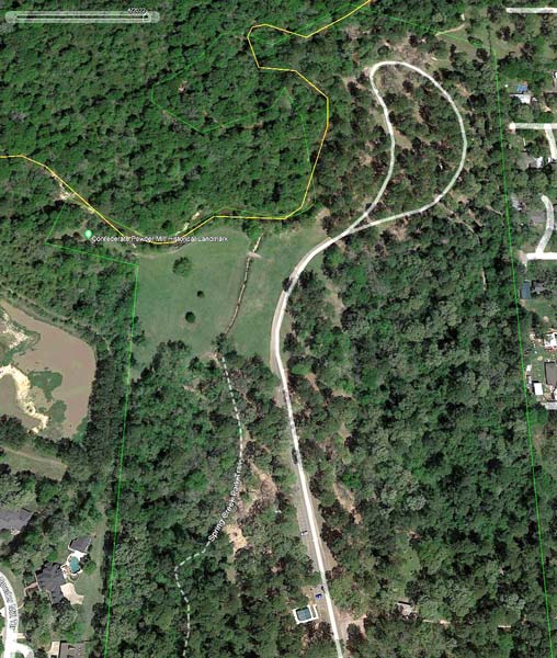
We knew it was in rough shape, as it was almost twenty years old. Originally, the course was placed as an Eagle Scout project on January 1, 2004, by Jeremy Powell. However, we had a basic idea of where the course should be from the paperwork we found online and some limited information on the Waymarking site.
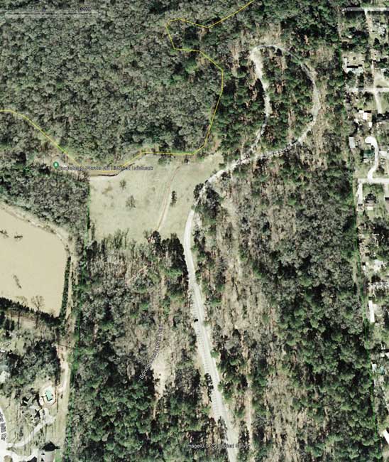
Twenty years is a long time for a park, and the scout camping area, in particular, at this park has been significantly overhauled and improved over the years. Likewise, the park has grown and trails have changed as well as the vegetation has grown up. Taking a quick peek at Google Earth shows how sparse the vegetation was in 2004 versus today.
Finding the Starting Point
From the Waymarking site we had the latitude and longitude coordinates (N 30° 06.424 W 095° 39.265) for the starting point, which is was the sign where the course instructions were posted. Unfortunately, the sign had deteriorated and was removed years ago by park staff. However, when the points are plotted on a map, it shows the location directly along the trail in the Scout camping area. This seemed like a likely location and there was plenty of space where the sign could have been built. So, that is where we began.
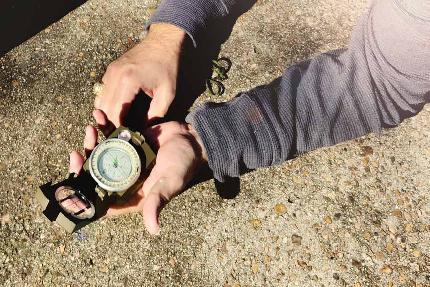
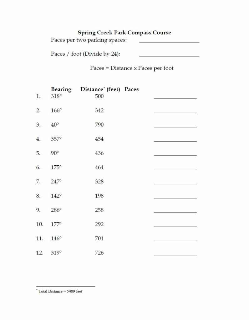
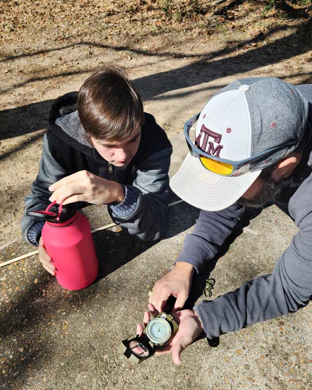
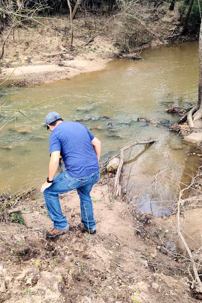
From here the boys took the first bearing on from the course instructions – 318° – and set off the 500 feet. They had previously calculated their paces per foot, as per the instructions.

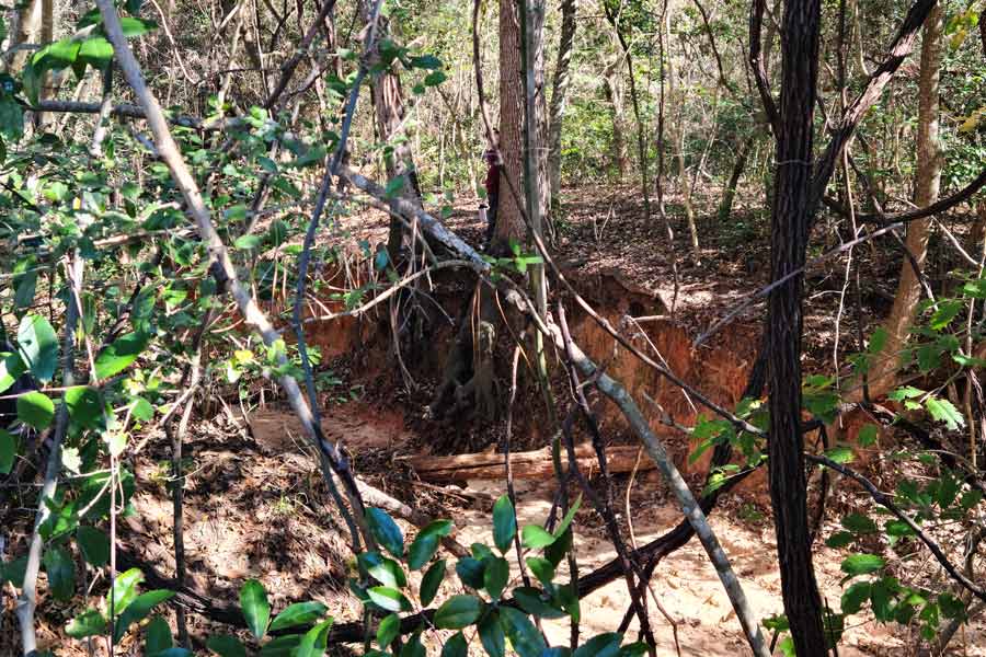
This bearing led directly through some pretty dense vegetation. The boys picked their way though. I walked around to get back on the bearing on the other side of the copse. Due to the heavy brush it was hard to count paces accurately, but directly along the bearing we found a post!
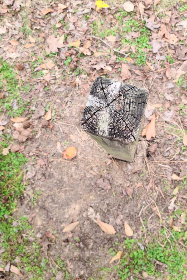
First Signs of Success
The weathered wooden post sits lonely on the southwest edge of the current ultimate frisbee course field. There are no markings on it save for what appears to be some faded paint on the top. It could be a ‘1’ or ‘4.’ It could be many different things but, without a doubt, it is an orienteering control post marker. And, it was just about where we expected to find one.
Feeling confident we had found the post we were supposed to the boys set their next bearing – 166°. This bearing led down a well-trod trail so we set out to pace out 342 feet.
First Signs Things Would go Awry
The boys paced and found themselves directly along the banks, or possibly in the middle, of a creek. This was certainly problematic. Our area has had significant flooding, which most certainly has led to erosion along these creeks. Or, at the very least, the park would have come along to rectify and clear out drainage and debris issues.
The instructions said the posts could be within ten feet, so the boys scouted the area. They crossed the low stream and kept an eye out for anything that could be an old post, or one that had fallen down in the undergrowth or washed into the creek. Unfortunately, we found nothing. So, they returned to the position where it should have been and set the next bearing hoping for better luck ahead.
From this location the bearing of 40° took them back up the trail, across the creek and skirted the field. And, then it crossed the road.
This is a problem. The instructions clearly stated that the orienteering course will not cross the road.
However, using logic led us to concede that without the post our bearing could have been off. Fortunately, this route ended in an area that is very clear. So, even if we were off, which was likely since we had crossed the street, looking around showed that the post likely would have been placed on the “corner” of the creek bend so that the course could go up and around the road’s loop. We adjusted to the corner and searched the area. There is no post anywhere in the vicinity. But, the course had to make the turn, and, based on the next bearing of 357°, the post had to have bee originally posted in the vicinity. So, the boys chose a location that could make the turn and not run back into the creek and set their next bearing.
This bearing led us up toward the north end of the loop. Again, we were unsuccessful at locating another post. However, it seemed likely from the next bearing of 90° that we were continuing around the loop. In this way, the boys went to the likely location and set the next bearing. This landed us directly along a fence line.
The fence is clearly a recent addition to the park. Certainly it is not twenty years old. Furthermore, on the opposite of the fence is an old cemetery. It stands to reason that the park, or some such, are protecting the cemetery and that if there was a post here it was removed to build the fence. That being said, it was certainly within ten feet of where the post should have been so they set their next bearing, 175°, which turned us back south around the opposite side of the loop.
Here things certainly went downhill. We were unable to locate another post where the following four positions and we could tell the last few were going to take us quite a long distance down and back. From the bearings of likely locations we realized it would take us near and possibly through the existing archery range. Clearly, we would not be able to follow the bearings in a straight line. It was time for a break.
Eureka! We’re Back on Track
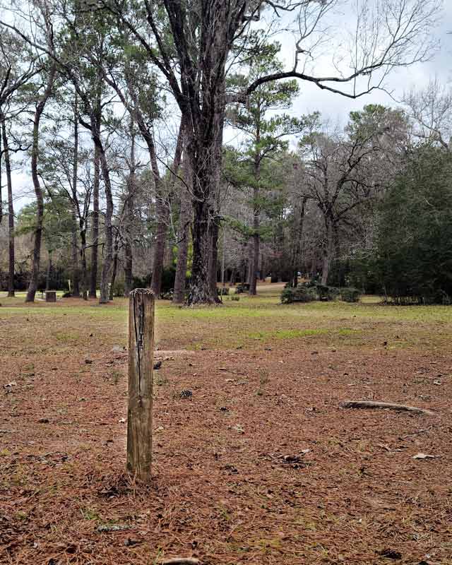
We found some picnic tables to take a break on. While regrouping and trying to determine the next best course we saw a familiar sight – two more posts.
These posts stand lazily in the shaded picnic area on the east side of the road across from the Scout Camping area. One of the posts has faded letters adorning the southern side. You can just make out C-O-U-R-T-S. Courteous! We were back on track.
Using just the bearings on the sheet we sketched out how the course should roughly look. There should be two posts fairly close together for posts 11 and the post that should mark the finishing point. Again, the boys set their bearings and headed out. If the posts and bearings were correct we had a relatively good idea where post 12 should be. All the same, the vegetation is substantially more dense than in 2004 and there is an archery course directly in the way.
They set out.
Running in front of the archery course on its south side is a trail that leads to a trail that runs along the eastern border of the park. We used this trail to set get back on the bearing but estimating feet from paces was nearly impossible. Here we found dense vegetation. We walked along the eastern trail looking for the post and the boys ventured into the vegetation to see if it would appear. Regrettably we were unable to located post 12.
However, we did have something that we did not have when we began – the exact location of three posts. We dropped pins on them to mark their coordinates and left with a plan.
Wait. What? There is Another.
Though, before we left we stopped to talk to the park rangers. They informed us that yes, the original starting point sign had to be removed a few years before and that there were a few remaining posts around the park – including near the entrance on the south end of the park! From the course instructions we knew we were circling the 2004 Orienteering Course so these new posts were a revelation.
We drove to the south end of the park and, sure enough, near the totem pole and tennis courts were a few numbered posts. I was unable to find any information about this course but am quite sure it is not related to the 2004 course and that it predates it. (If you know anything about it comment below or use our contact form – I’d love to hear about it).
Orienteering Adventure 2.0
While we had a great time on a really nice winter day we were intrigued. Finding the three remaining posts gave us new information to work with and we wondered if we could actually find more.
At home we plotted the position of the starting point given on Waymarking. They also listed having .GPX, .LOC, and .KML files but those were only for premium members. The membership is linked to geocaching, as they are owned by the same parent company. We became members. Unfortunately, the only points in those files was the original latitude and longitude coordinates listed on the site. (So, if you are thinking about it go ahead and save your $5.99)
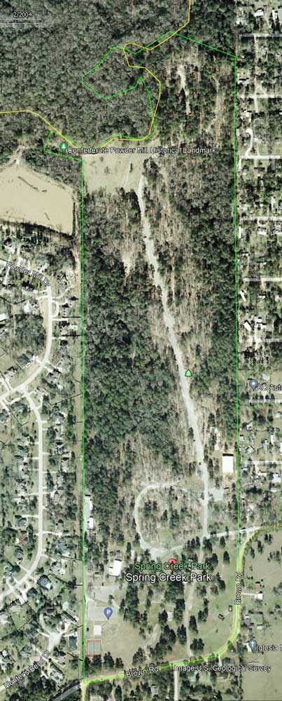
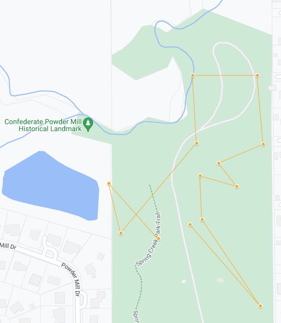
Using the starting point, original bearings and distances, and a tool from GPS Visualizer I was able to plot the course on a Google Map. The course as it should lay is shown below in yellow and on the Spring Creek Orienteering Course Map on layer three titled (spoiler alert) ‘INCORRECT – Course Start from Waymarking Lat Long.’
As you can see the course goes out of the park boundary and crosses the road multiple times. We could tell something was off – most likely the starting point.
However, we now had three control points to use as well. They are located on layer one titled ‘Remaining Posts’ and identified by dark red points. Below you can see them overlaid with the Incorrect course. What this makes clear is the course is not in the correct position even though Remaining Post 1 is directly in line with the presumed starting point. But, what if Remaining Post 1 was not the first position. Despite it being on the “correct” bearing the distance is actually too short.
Adjusting the Course
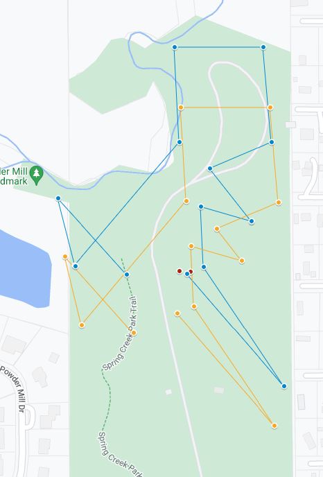
We could also see that the course was too far south. It could not, given the distances we knew, make it around the loop without crossing the road. So, we postulated that Remaining Post 1 was actually Control Post 2, the second location if you were following the bearings and distances on the 2004 Orienteering Course worksheet.
When you adjust the course to make Remaining Post 1 the second stop the course not only makes it around the road loop but lines up almost perfectly with Remaining Posts 2 and 3. This route is outlined in blue on layer 2 ‘Historic 2004 Course Route if ‘Remaining Post 1′ is actually Post 2.’
This makes it clear that the starting points on Waymarking were not accurate and that this was the likely route for the 2004 historic course. It does still cut some boundary and creek corners, but that seems like a reasonable deviation for twenty years of erosion and rebuilding.
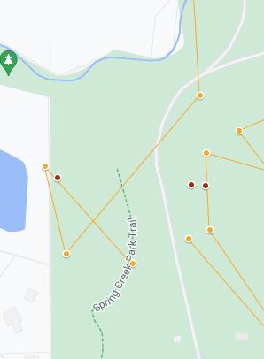
Just to be sure we followed all our leads we also plotted the course if the post with COURTEOUS painted on it was actually Control Post 5, since it is the fifth point of the Scout Law. However, this was quickly revealed to be not possible as it would put many of the points outside of the park boundary – which are unchanged since 2004. This route is outlined in green on layer five, ‘NOT POSSIBLE – Route if ‘Remaining Post 2″ is actually Post 6 ‘Courteous’.’
Orienteering the Historic Course…Again
With the Historic 2004 Course points plotted and a new starting point established we headed back to Spring Creek park to see if we could track down any other Remaining Posts. With the assistance of GPS to ensure we ended up where we needed to be, our family ran the course again.
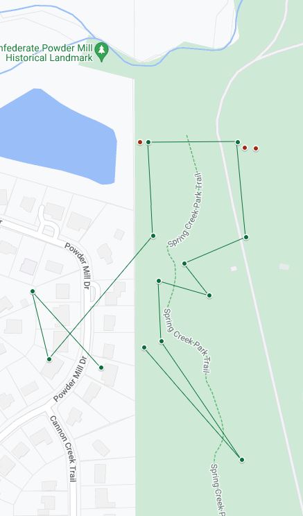
From our new starting point Post 1 should be on the corner of the fence line as your turn west to visit the Confederate Powder Mill Historic Landmark site. The corner has a newer trail sign in the approximate location. Post 1 was likely removed when it was installed.
Using that corner the next bearing leads directly to Remaining Post 1, which means it is actual Post 2. The paint on top does not look like a two but it is entirely possible that it is just graffiti of some sort.
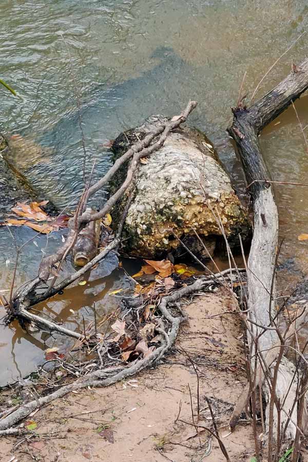
Turning toward the location of Post 3 leads across the Ultimate Frisbee field and directly into the creek. This area is prone to flooding, which naturally leads to erosion. Any post placed here would have fallen in to the creek years ago. And, as luck would have it, in the creek at this location is a round concrete base with rectangular wood inside. We also found heavily eroded rectangular wood nearby. We cannot say that these are the remains of the post but it is coincidentally in the correct location.
After Post 3 the bearing leads you north into an area of the park that has seen a lot of water damage and change. Any post here is certainly lost to the ravages of nature. Turning to the next bearing leads directly into the cemetery fence. Again, any post in this area would have been removed to build the fence. Here the course turns south. We skirted the road (but did not cross it). This part of the park was very clear with small copses of trees. We inspected them as we went and nothing was found. It is likely these either eroded away, were removed, or damaged by park goers over the years. The same is said for the location of the following post, Post 7. Our bearing placed on the map does show it crossing the road but this is likely a slight error of the bearing listed. It should still have been very close and plainly visible if it were still standing.

Back into the Woods
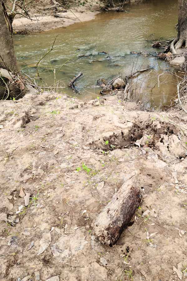
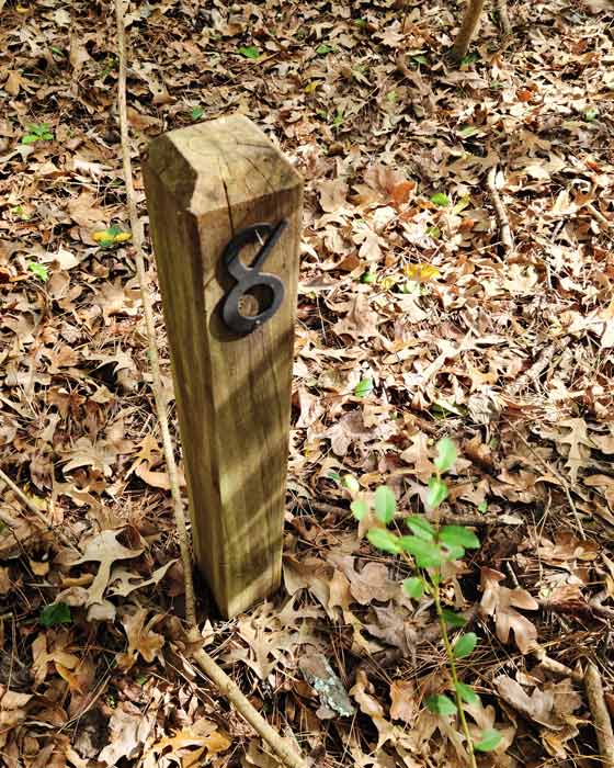
From here our bearing again led into densely packed vegetation. The eastern park boundary trail runs fairly close so we walked around until we were about parallel to the calculated position and then the boys went back into the woods.
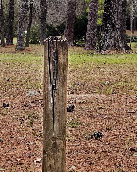
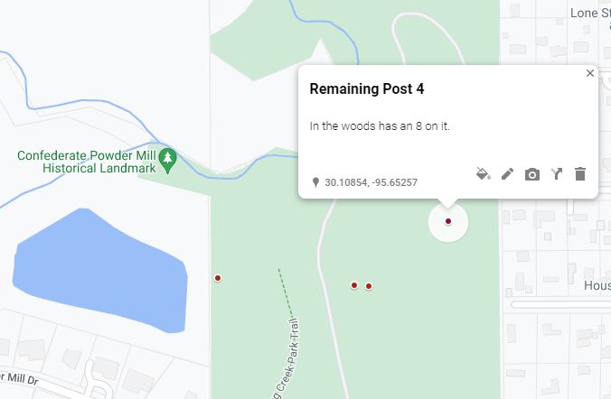
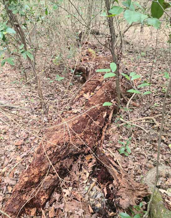
The were far enough in that they were not visible from the trail and just as they were about to give up they found another post! This one had a metal number 8 still attached. It was exactly where we calculated it to be! On the map it is called Remaining Post 4.
Buoyed by our success we searched for Post 9, but what once was clear was heavily grown over. Because the location is in a wooded area we had high hopes of finding it undisturbed, but the only possible place it could have been, if any part remained, was under a tree that had fallen long ago. It was gone.
Post 10 is the post we named Remaining Post 3.
We set off to find Post 11. Since it is opposite the archery range we took the trails around. Our search produced no new post and once we were in position we estimate it would have been along the trail and likely was removed either to clear trails or to put up newer trail sign.
Though we were only able to find one more post (and possibly a cement base) the fact that it is exactly where we postulated confirmed we found the correct course location and where the course actually began. With that knowledge we walked back over to the start and used the photographs from the Waymarking site to narrow down where the sign could have been.
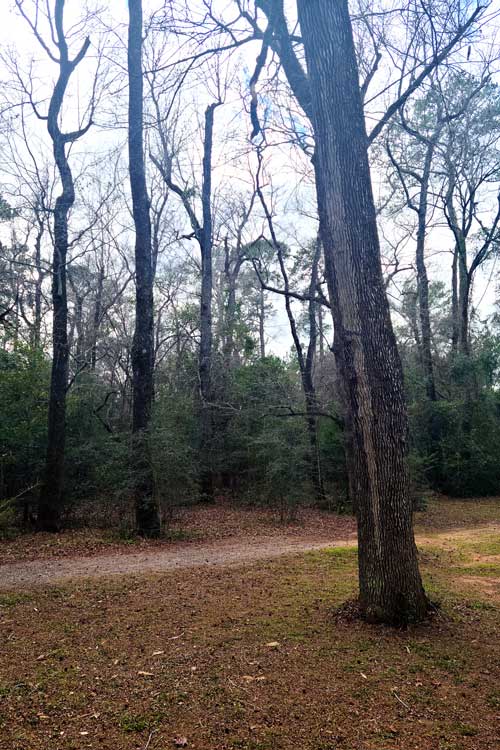
Fortunately, the tree directly behind the sign has a distinct marking. A lighter colored vertical stripe in the bark. You may not think that sort of feature would remain after twenty years but we found the tree!
A New Orienteering Course
This was such a fun family adventure, but you are probably here looking for a current course at Spring Creek Park. Good news! One is in the works as another Eagle Scout project. So, within the next year or two there should be a brand new orienteering course installed at Spring Creek Park.
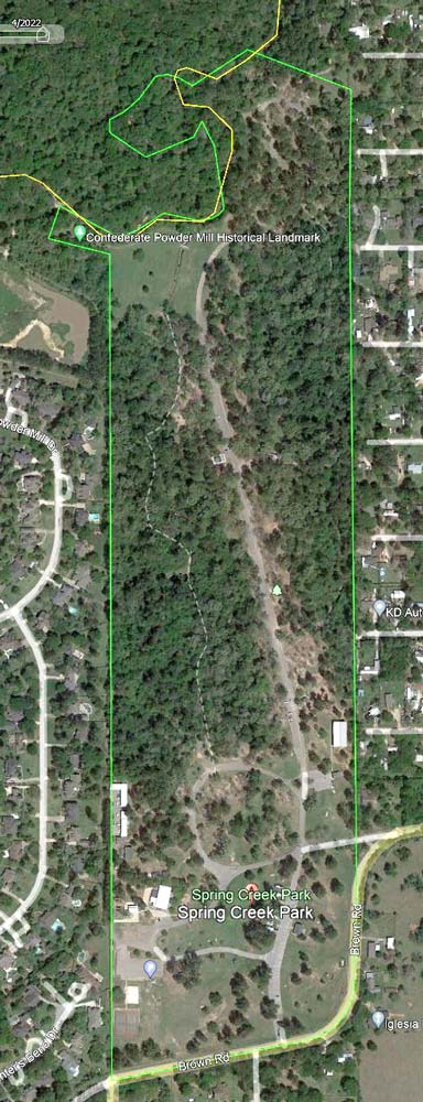
In the interim, I did put together and easy course, using existing landmarks. It is outlined in green khaki on the map as Layer 5, ‘New Course‘ and there is a new worksheet for scouts.

Access the Spring Creek Park Orienteering Course Worksheet and subscribe to Adventure CUBS Printables & Digital Downloads below. The Spring Creek Park Orienteering worksheet will be emailed to you. The map above and latitude and longitude points are only for adult reference. You do not need them and should not use them to run the course.
Let’s go orienteering!
If you run the course be sure to send us a note or comment below.