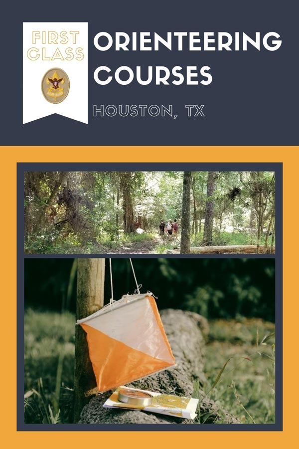
7 Orienteering Courses around Houston You Need to Try
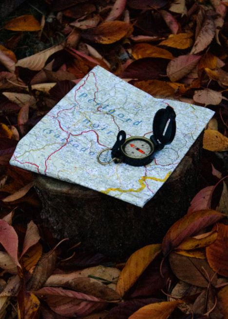
Orienteering is the art of using a compass to find your way. Some might say a lost art. Fortunately, it is a skill that features prominently in several scouting adventures. Most notably, completion of a 1-mile course is required as part of the Scouts BSA First Class Rank.
Due to the nature of orienteering courses…being that they are in nature, they tend to degrade and are often not maintained and forgotten. As such, before setting out on your adventure do try to verify the course is still in existence. Or, at least prepare for a bit of an adventure.
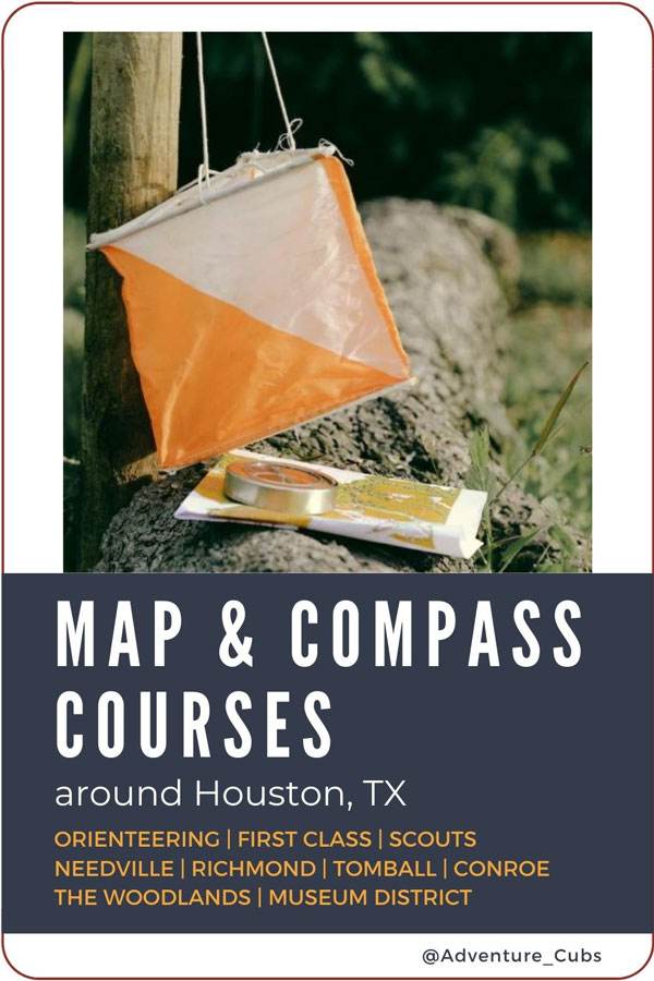
Orienteering Courses around Houston
A note on the orienteering courses provided by the Houston Orienteering Club (HOC)
If you are here looking for a traditional map, compass, set a bearing sort of course then the HOC courses may not be the place to start. They are not laid out as such. They use UTM and MGRS and some maps do not have any points (like the ones for Hermann Park). These types of navigation are slightly more advanced and some require different tools than your basic map and compass.
Alright, let’s find somewhere to get outside and explore!
BOY SCOUT CAMPS
Camp Strake and Bovay Scout Ranch have onsite orienteering courses for use by scouts in residence. Accordingly, consider attending camp or hosting your troop’s weekend campout at the facility to utilize the course.
Brazos Bend State Park | Needville
Created
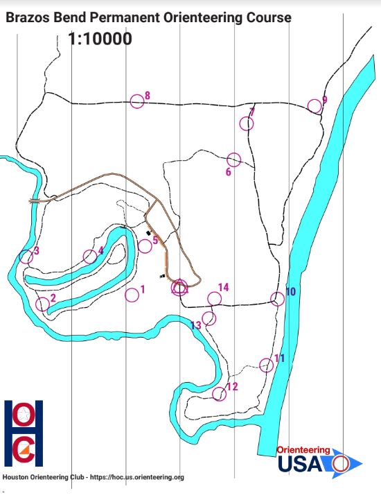
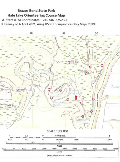
The course at Brazos Bend State Park was originally placed by a member of the Houston Orienteering Club in 1990, covered 8 miles, and had 19 posts. In 2010, Lucas Jacobson, of Troop 220 for his Eagle Scout project, refurbished and updated the course to be more user-friendly for scouts. His two-mile version utilized some of the previous course and created a new map.
Later two more courses were developed. It is unclear who developed the most recent derivation of the Hale Lake course, but information is found on both the Friends of Brazos Bend and HOC websites. These maps date to 2018-2019 so should be current enough to be used. The most recent course is near the Nature Center and created by D. Feeney in 2021.
Course Details
The 1990/2010 Course
The 2010 course was a refurbishment and improvement of the 1990 course. Information about its coordinates, map, and how to use it can be found here. It is unknown if any control points for this course exist as many seem to be incorporated into the more recent course. If they do the posts are numbered and are either brown or white. To use this course for scouting focus on points 14-19.
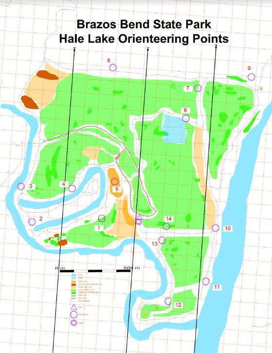
2018-2019 Hale Lake Course
Based on map overlays the Hale Lake courses on both the Friends of Brazos Bend (FOBB) and HOC websites use the same points. Further, many seem to line up with points from the historic courses. As such , it stands to reason if you attempt these courses you should use the more modern course as the control points from the historic course have likely been replaced and/ or updated to match the 2018-2019 course designations.
The FOBB Map is the most detailed but does not have numbers. It does have a worksheet but it uses UTM.
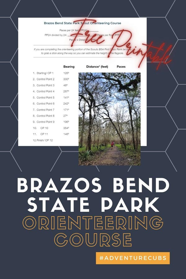
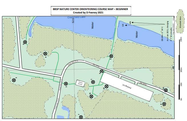
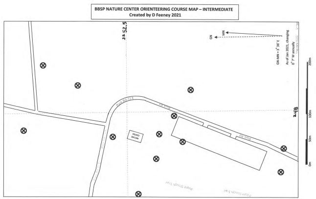
2021 Nature Center Course
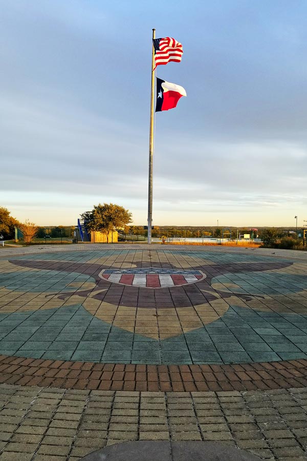
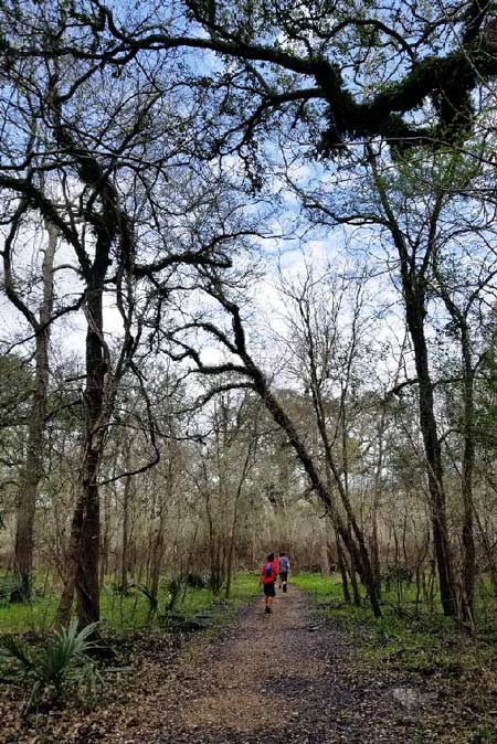
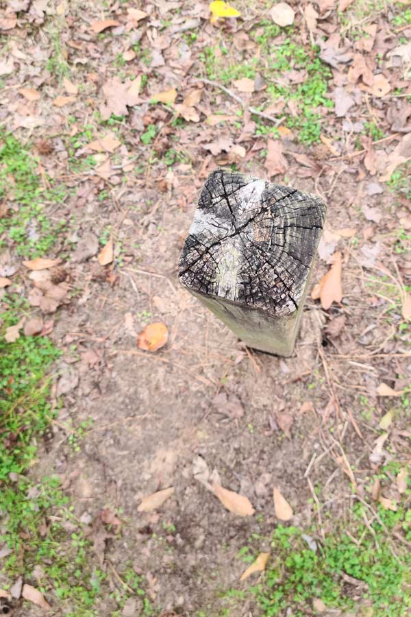
The Nature Center course is perfect for scout use as it clocks in at just over a mile and begins at a flag pole (which is perfect for the second part of the requirement where you need to figure the height of an object). There are twelve control points – look for a 4” x 4” green post with a number and letter on it.
The course can be attempted at three different levels – beginner, intermediate, and advanced. The main difference is the level of detail on the provided maps. The control points are all the same.
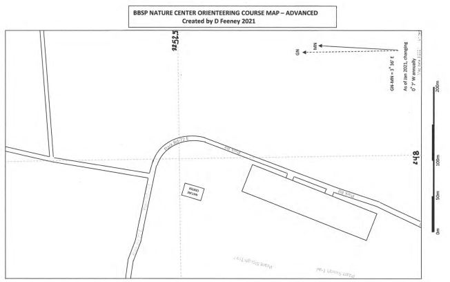
While the course is great for beginners and for scouting purposes the worksheet provided does use UTM. We have adapted the instructions for more scout-friendly map and compass course. Download a copy of that worksheet by opting into our newsletter. Also included are quick instructions on how to calculate height using a stick – which will fulfill the second part of the First Class 4a requirement.
Starting Points
The Nature Center course begins and ends at the flag pole in front of the center.
The Hale Lake course starting point just off the Day Use parking area near the White Oak Trail trail head at 29°22’31.0″N 95°34’56.3″W (29.375278, -95.582306). You will finish in about the same location.
George Mitchell Nature Preserve Orienteering Course | ThE wOODLANDS
Created
2018 by The Woodlands High School Air Force JROTC Orienteering Team. Post locations were verified current by the team in 2020 and several scout troops have utilized the course as recently as 2022.
Course Details
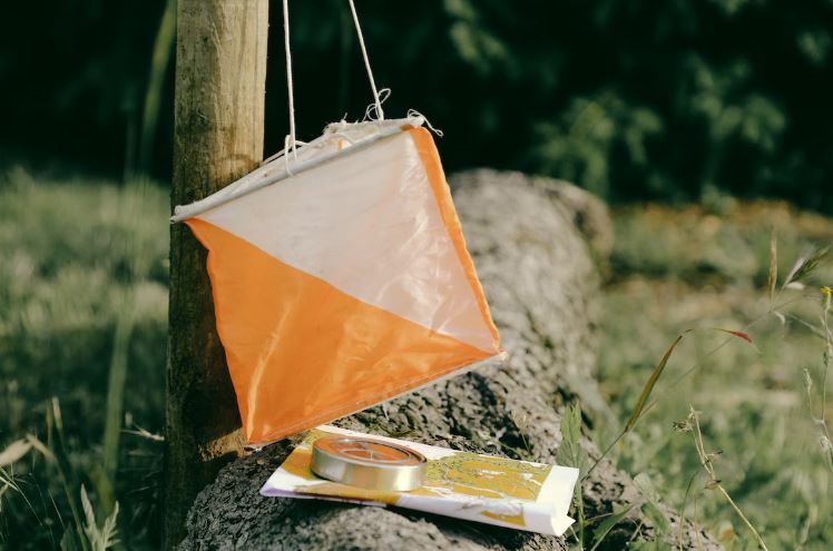
The course has 15 wooden posts that are about 3 feet tall. They are painted white with an orange triangle at the top (the International Orienteering symbol) on all four sides as well as a metal placard on the top. Painted in white is a three letter identification code unique to each post. The instructions, map, and starting point for the course are found on the HOC website.
This course is designed to use a map and compass. It is a beginner to intermediate course but can be adapted to various levels. The original map did not number the control points so you can make your own course to suit. Some posts have a clear line of site from trails and some will not. For an easier experience consider exploring during the winter, when the vegetation will be the thinnest, and using the newer 2019 map as it does have the control posts numbered.
We have added the control posts as a layer on the map above, but these should not be used as an accurate guide of longitude and latitude points (we have not yet gone out to verify locations). They are probably close to within 100 feet, but that can be a big discrepancy in the wilderness. These points are only added as a best guess, based on the HOC 2019 map to help suggest various routes that will be long enough to meet the First Class 4a requirement.
To view the suggested routes, view the Orienteering Courses around Houston Map. Navigate to the George Mitchell Preserve OC Layer. Just below are five layers, turn on the GMOC Route of your choice to see it overlay on the George Mitchell Preserve Map.
Suggested Routes:
- 1 to 15 – 4.67 miles, Goes in order point to point beginning and ending at the start
- The Clock Loop – 2.34 mile loop beginning and ending at the start. Start-2-13-9-10-11-4-1-5-14-8-6-7-15-12-3-Return to Start (either direction).
- Close to the Trail – A 1.68 mile loop beginning and ending at the Trailhead. These posts should be closer to the trail than the others and thus easier to see and find for those who don’t want to, necessarily, go too far off the trail. Start-13-9-10-11-1-5-15-Return to Start
- Big Dipper – A 1.25 mile course, beginning at CP 04 and ending at CP 09. 4-1-5-15-4-13-10-09
- Cassiopeia – .76 miles from the start to the last point. Start-4-3-5-15 (If you set a bearing from the last point (CP 15) to return to the trailhead it will add .45 miles.)
Starting Point
Begin at the trailhead that is indicated with a purple triangle on the map.

Course Details
This course uses existing landmarks as points – there are not specific orienteering course markers to look for. It was created by Troop 55.
Starting Point
Troop 55 Orienteering Course | 1500 Hermann Dr., Houston, TX 77004 – There are two starting options the middle of the entrance to the tunnel leading into the Cherie Flores Garden Pavilion at Centennial Gardens or the middle of a triangle of grass on Hermann Dr., southwest of the garden entrance. Both are pinned on the above map and pictured and marked out on the map and information pages created by the troop (linked in the section heading).
Houston Orienteering Hermann Park Courses | They have five courses varying in distance and number of control points. All suggest you park in Lot H, near Centennial Gardens. None offer bearings or points.
Pecan Grove Park Orienteering Course | Richmond, TX
Created
2019
Course Details
There are seven orienteering courses (or versions) at the park. They vary in skill level and distance.
Starting Point
All courses begin at the 2.5-inch bronze monument on the ground on the north side of the park’s Information Kiosk. The kiosk is 300 feet from Pitts Road – look for a small brick structure on your right as you enter the park.
Spring Creek Park | Tomball, TX
Created
Pre-2002, 2002, and TBA
Course Details
There are two historic course and one course that is in development as an Eagle Scout Project. The historic courses are mostly lost, for more details and for an interim course visit our post Lost and Found | Orienteering Course at Spring Creek Park.
Starting Point
Interim Course starts at the Northeast post of the bridge that leads to the Ultimate Frisbee course.
The new course TBA.

W.G. Jones State Forest | Conroe, TX
Created
2019
Course Details
The orienteering course at Jones Forest was created by the HOC – Houston Orienteering Club and uses UTM and MGRS to find control points. The control points are metal posts, about 3 feet tall and painted white and orange. There are geocaches in the Forest as well (the map is here).
Starting Point
Parking lot
If you have traversed one of Houston’s local orienteering courses please leave a note below! Let us know anything that will help local scouts best find and navigate the courses. In turn, we will keep the post up to date on current conditions and accessibility.